Posts

Showing posts with the label disused railway

Picture of the day 17/05/23 - Welcome to the jungle

Image
  Today's shot comes from the heavily overgrown trackbed of the Lambton railways Littletown & Sherburn branch. The picture was taken near the site of Hunter's house pit.

Picture of the day 09/05/23 - Sneak peek...

Image
  A little sneak peek from an upcoming project. No prizes for guessing which railway this is/was!

Picture of the day. 26/04/23 - Trains no more

Image
  A quick snap of the remains of Whitwell level crossing on the Leamside line. I passed over here yesterday whilst out exploring the Shincliffe and Sherburn areas. The leamside line is currently mothballed with no trains having ran on it in over 30 years. 

Picture of the day. 17/04/23 - Walking the Stanhope & Tyne Railway

Image
  Looking down Nanny Mayer's Incline My latest disused railway gallery is now live on my website. It covers a walk along the Stanhope & Tyne railway from Lydgetts junction to the top of Weatherhill incline. Below is a small selection of images from the gallery, see individual photos for more details. The full gallery can be found here If you'd like to learn more about the Stanhope & Tyne railway then I highly recommend the books by Rob Langham

Sunderland & Durham Railway - Ryhope to Murton

Image
 Sunderland & Durham Railway - Ryhope to Murton Several weeks ago I walked the trackbed of the Sunderland & Durham railway from the site of Ryhope station (2nd site) up Seaton Bank to Murton station (site of). It was an enjoyable walk and below are some of the highlights, with a bit of information. More information on the line can be found here. The platform remains and NER footbridge at Ryhope Station (2nd site). This shot is looking toward Seaton Bridge over the A1018 starting the climb up Seaton bank Bridge over the A19 with Seaton in the distance The Site of Seaton banktop station the station remains in the bushes Seaton bank top. The Seaham & Rainton railway crossed from left to right at this location Looking towards Murton station and the junction for the line to Durham Elvet. Station masters house on the left Murton station remains, possibly platform? Station access path, which was cleared by locals

*Video* The Lanchester valley railway. Part 1-3

Image
 

5 little known Industrial railway sites along the River Wear

Image
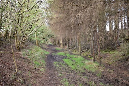
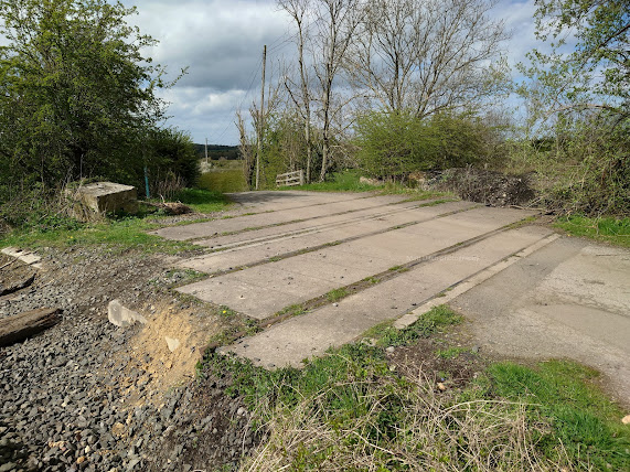
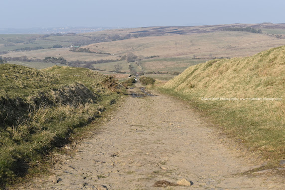
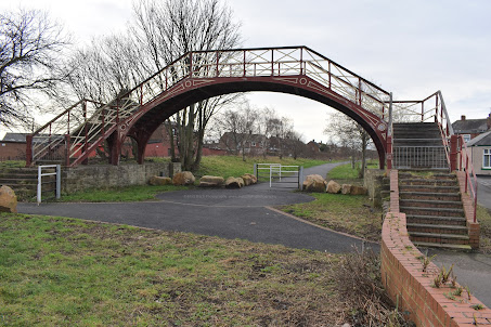
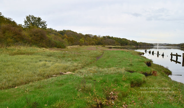
5 little known Industrial railway sites along the River Wear A few days ago I was exploring my local area using Rail Maps Online . I noticed that since my last visit to the site a few railways had appeared in my area, I thought it rude not to go for an explore! I didn’t expect to find much at any of these sites as many of them fell out of use many years ago and have been reclaimed by nature, but I was pleasantly surprised…. Site 1. An unidentified shipyard on the North side of the River Wear I haven’t been able to find too much out about this site. It appears to have been abandoned around the 1930s. The buildings were on the left where the thick undergrowth now stands. On the right was a wharf, the remains can still be seen. On closer inspection of some old OS maps it would appear that the tracks ran along the wharf. I believe the railway system here was narrow gauge, but I was unable to find anything due to the boggy nature of the area. Site 2. Incline to a Quarry & another shipy

The Wensleydale Railway - Hawes to Garsdale

Image
 The Wensleydale Railway  - Hawes to Garsdale  History Tucked away in a remote corner of the Yorkshire Dales is Hawes station. Situated on the disused section of the Wensleydale Railway, Which ran from Hawes Junction (later renamed Garsdale) on the Settle & Carlisle railway to Hawes. The station was originally opened in 1878 and was part of the Midland railways "Hawes Branch". There was an end on junction with the North Eastern Railways line from Northallerton at Hawes station. The North Eastern railway, and later LNER ran the majority of the services over the line. The exception being a service to Hellifield nicknamed the "Bonnyface" which ran as a single day return. The line towards Northallerton closed to passengers in 1954. But Hawes was still served by passenger trains from Garsdale till 1959. Freight and goods trains ran until 1964 when the full line was closed. Today the section from Redmire to Leeming Bar and Northallerton is still open as a heritage li

Cockermouth, Keswick & Penrith Railway. Part one: Cockermouth to Keswick

Image
 Cockermouth, Keswick & Penrith Railway   Part one: Cockermouth to Keswick 46458+46426 leaving Cockermouth 02-04-66  John Boyes. Armstrong railway photographic trust. www.arpt51a.com. No authourised use. Introduction The Cockermouth, Keswick & Penrith Railway ( CK&PR for short)  was a railway in North West England that linked the town of Cockermouth with Penrith on the West Coast mainline. There were 10 stations on the line with one of the most noteble being Keswick.  Permission to build the railway was granted in 1861 when an act of parliament was passed with work starting in May 1862. By the early summer of 1864 inspection trains had ran for the directors of the line. It officaly opened to goods traffic on the 1st of Novemember 1864 and for passengers on  the 2nd of January 1865, although passenger trains for an agricultrial show had ran on the 29th of September 1864. The railway had support from the London & North Western Railway and the Stockton & Darlington rai