5 little known Industrial railway sites along the River Wear
5 little known Industrial railway sites along the River Wear
A few days ago I was exploring my local area using Rail Maps Online. I noticed that since my last visit to the site a few railways had appeared in my area, I thought it rude not to go for an explore!
I didn’t expect to find much at any of these sites as many of them fell out of use many years ago and have been reclaimed by nature, but I was pleasantly surprised….
Site 1. An unidentified shipyard on the North side of the River Wear
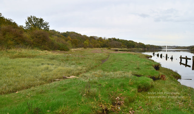
I haven’t been able to find too much out about this site. It appears to have been abandoned around the 1930s. The buildings were on the left where the thick undergrowth now stands. On the right was a wharf, the remains can still be seen. On closer inspection of some old OS maps it would appear that the tracks ran along the wharf. I believe the railway system here was narrow gauge, but I was unable to find anything due to the boggy nature of the area.
Site 2. Incline to a Quarry & another shipyard
The next site I explored was again located just off the River Wear. This site sits not far from the A19 river Wear bridge. The above picture is looking up the long disused incline which linked the River with a quarry situated near Woodhouse Farm. According to the old OS maps this site was out of operation by the 1890s. I should point out that the incline, which is now a path, has been closed due to unstable rock faces. Given the narrowness of the incline I again think this must have been narrow gauge.
The quarry is now fenced off and heavily overgrown, so I did not get a chance to explore that.
At the bottom of the incline was another ship building yard with a steel works and Brickwork's. This site also had a small but extensive internal railway system, but like the incline it was out of use by the 1890s. I could not explore this site as it is now a private residence with big signs saying “Beware of the Dogs”. I did not want to take my chances!
Site 3. Coxgreen Quarry.
Located on the South side of the Wear above the small village of Cox Green was Cox Green Quarries. One of a number of Sandstone quarries in the local area. The railway system here, again I presume it to be narrow gauge was used to transport sandstone to waiting ships on the River Wear. The above wagons, or tubs as they are also known appear to be sitting on part of the former trackbed. I can’t confirm if these are original to the site or if the short length of track they were sitting on is original either. The OS map shows that there was a short tunnel near this spot which linked this quarry with another small quarry located on the opposite side of the road behind where the photograph was taken.
Site 4. Old sandstone quarry tunnels.
Located a short walk from the village of Cox Green are a number of partially bricked up/ filled in tunnels. These tunnels once connected the River Wear with Low Lambton Sandstone quarries. The quarries have long been filled in but the tunnels remain. The above image shows the entrance to “Tunnel 1” and the below shot shows the inside of the tunnel.
Located next to tunnel 1 is the remains of a building, presumably this was an office or perhaps a stable as I’m led to believe that the wagons were hauled through the tunnels by Ponies.
A short walk from Tunnel 1 lies No’s 2 &3. No.2, pictured below appears to be in the best condition of all the tunnels. It is possible to enter this tunnel, but you do so at your own risk. This tunnel runs for several hundred yards before dead ending at a collapse. At places along its length it is possible to see sleeper indents from where the track was. Near this location was “the drops” where material from the quarries was loaded onto waiting ships. There was a modest amount of tracks here and a saw mill. Nature has totally reclaimed this area, and it’s hard to imagine that this was once a busy industrial site.
The entrance to Tunnel 3 is located to the right of Tunnel 2, and it also sits lower. As the blow picture shows this entrance is just about filled in, although I was able to stick my camera through the small opening to photograph the interior. After a short distance it appears that this tunnel has been walled up as well as being filled in.
Finally, I came across the entrance to Tunnel 4, again this was located a short walk westwards from the previous tunnels. Again this tunnel has been completely filled in, but it would appear that someone has gone to the trouble of digging out the top of the arch.
Site 5. Low Lambton Waggonway.
Looking up the low Lambton Waggonway in the direction of Penshaw. The waggonway connected the mines around Penshaw with the low Lambton staith and low Lambton drop. The line climbed steeply from the River running parallel to the Leamiside line, which sits to the right and is located on a steeply sided embankment. The waggonway would finally reach the Leamside line at Penshaw near the junction of the Penshaw branch to Sunderland. A 1900s OS maps show the line still in place, but it had gone by the 1920s.


Comments
Post a Comment